Your cart is empty
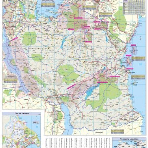
GT Tanzania Travel eMap
£5.58
Product Description
The Globetrotter Travel eMap of Tanzania caters specifically for the needs of tourists who are new to a destination. The town plans of the major centres pinpoint key buildings and places of interest as well as where to stay. Distance and climate charts enable travellers to plan their visits.
Scale: 1:1 900 000
- The eMap covers: Tanzania
- Distance and Climate Charts enable travellers to plan their visits in advance.
2 reviews for GT Tanzania Travel eMap
Add a review
You must be logged in to post a comment.


safariclinton1 – :
Our family used this emap in a self drive overland holiday and it was great to navigate into Ngorongoro crater to the Seregeti and then south from Lake Victoria to Morogoro Ruaha Safari Park. Spectacular and importantly dependable navigation throughout the whole region!
Nic – :
A really great map, one of the best around. Our family used it on an overland trip to get from Namanga to Arusha and onto Ngorongoro crater to Simba camp and then onto the Seregeti for camping. Then onto lake Victoria and south to Dodoma. Fantastic eMap!!